Historic maps of Lodsworth
The following maps of Lodsworth or maps showing Lodsworth have been found. Parts of some of these are shown in the gallery below.
- ‘Map of Sussex’ by John Speed published in ‘The Theatre of the Empire of Great Britaine’ pp.9-10, London 1610 (the first atlas of Great Britain)
- ‘Survey of the Landes and Common of John Mills beinge freehoulde lands called by the names of Fizlee and Fizlee Common’ 1629, held by West Sussex Record Office (WSRO)
- ‘An Actual Survey of the County of Sussex’ by Richard Budgen, London 1724 (the first large scale map of Sussex)
- ‘Map of Sussex‘ by Gardner & Gream 1795 published by W Faden (WSRO)(one inch to one mile)
- ‘Plan of Howick Farm’ 1788 (WSRO)
- ‘Map of Farm and Lands called Hurlands Farm’ 1778 (WSRO)
- ‘Moorland and Idles Farms Belonging to W. S. Poyntz Esq’ 1824 (WSRO)
- ‘Map of an Estate the Property of Charles Mitford Esq’1830 Surveyed by WHH Shorto (WSRO)
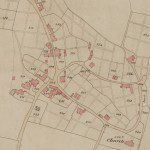
- ‘Lodsworth Tithe Map and Apportionment’ 1842 – Three copies of the original were produced: one is held by the Lodsworth PCC, one by WSRO and one by The National Archives in Kew.
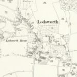
- 25″ to one mile OS map of Lodsworth village in 1895 (reproduced with the permission of the National Library of Scotland)
- 25″ to one mile OS map of Lodsworth village in 1910 (reproduced with the permission of the National Library of Scotland)
- ‘Inland Revenue Valuation Office Map’ 1910 – The survey by the Valuation Office resulted in comprehensive mapping and valuation of the country. The maps for Lodsworth are held by The National Archives, with copies held by WSRO. Sadly the Field Books for Lodsworth were destroyed during World War 2. They contained detailed descriptions and valuations of each house, and details of owners and tenants.
- ‘Plan of Howick, Shotters and Slong Farms in the parishes of Ambersham and Lodsworth’ 1929 (WSRO)
- ‘Report by Susan Madden including map and photographs of Beating the Bounds in Lodsworth’ 1999 (WSRO)


